![[Ocean Oasis - Teacher's Guide]](images/bnr-oo-tg.gif) |
 |
|
|
|
|
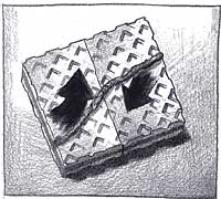
![[Plate Boundaries: Cookie Crust and Pudding Magma]](images/plateboundaries.gif)
What are the plates of Earth's lithosphere? |
|
In the Film |
Animated graphics portray the planet's mantle churning with heat. On Earth's surface, leading-edge, cool pieces of the lithosphere are shown sinking into the mantle dragging their plates behind them. Other animation shows the Baja California peninsula being pulled away from mainland Mexico and the peninsula drifting northwestward. |
|
Concept |
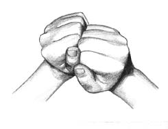
Plates (sections) of Earth's lithosphere move slowly over the mantle, pressing against one another, sliding by each other, or pulling apart. |
|
Objective |
To demonstrate movements at plate boundaries |
|
Content |
Science, language arts |
|
Background |
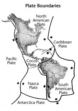
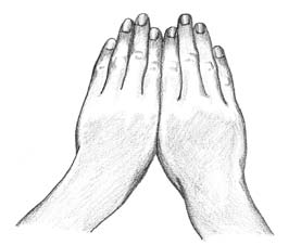
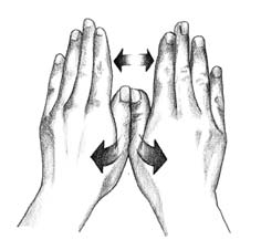
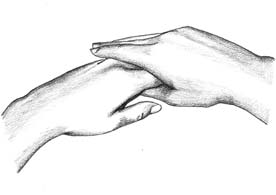
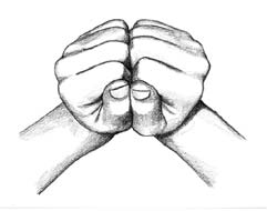
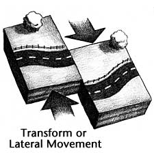
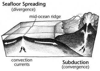
Earth's lithosphere (crust and upper mantle) is cracked into pieces, called plates. These plates, driven by convection currents, drift across the underlying mantle. Some plates pull apart (diverge), and some collide (converge). One plate may slide by another in a lateral (transform) movement. These movements cause earthquakes and contribute to the formation of mountains, volcanoes, and seas. The theory of plate tectonics explains the concept of Earth's lithosphere as being constructed of moving plates. Seafloor spreading, a divergent activity, takes place at mid-oceanic ridges as magma pushes up through cracks in the crust, pushing plates apart and forming new ocean crust. The mid-Atlantic ridge is the best known spreading zone. A smaller spreading zone is found in the middle of the Gulf of California, moving Baja California away from mainland Mexico. Subduction, a convergent activity, occurs as a plate with heavier ocean crust collides with a plate of lighter, continental crust. The ocean crust pushes under and sinks into the mantle. Ocean trenches, volcanoes, and island arcs are associated with subduction zones. Another type of convergent activity occurs when two plates carrying continental crust converge. Mountains may be thrust up at the boundaries. An example would be the formation of the Himalayan mountains. At transform boundaries one plate slips and grinds against another. It is a place where earthquakes occur as pressure builds, and then releases with the shifting crust. The San Andreas Fault, which extends from Northern California to the Gulf of California, is one of the most famous transform faults. It is along this fault that Baja California and part of Southern California are shifting northwestward. |
|
On the Web |
Plate Tectonics: How Baja California and the Sea of Cortés were formed—an illustrated step-by-step summary showing this process beginning in the Late Jurassic period—140 million years ago. |
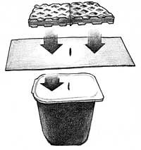
![[Materials]](images/materials.gif)
Part A
Plate Boundaries
Part B
Seafloor Spreading
Part C
Transform Faults |
|||||||
![[Procedure]](images/procedure.gif)
Part A
Plate Boundaries (whole class)
|
Part B
Seafloor Spreading (small groups)
|
Part C
Transform Faults (small groups)
|
Local Connection
Key Words
|
Continue to Activity 4: Convection Currents |
Teacher's Guide Contents
Field Guide | Site Index |
Ocean Oasis: The Film
|
|
© 2000 San Diego Natural History Museum |