![[Ocean Oasis Field Guide]](images/bnr-oo-field.gif)
| |

|
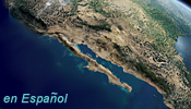
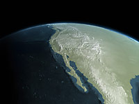
Baja California and the Sea of Cortés exist geographically because of plate tectonics. Movement of the Pacific and North American crustal plates began ripping the Baja peninsula and the western half of Southern California from mainland Mexico some six million years ago, opening up the Sea of Cortés in the process. Since then, the Pacific plate has moved some 330 km (200 miles) northwards carrying Baja California and peninsular Southern California with it. A step by step summary of that process is illustrated below. An animation from the film will be here soon. |
|
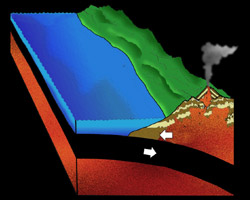
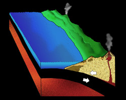
Late Jurassic Period: 140 million years ago |
|
|
Our story begins in the late Jurassic Period. Geologists have studied the rock formations of this time period and have discovered that conditions here were much different than that of today. Western North America looks much like western Indonesia with many offshore volcanic islands and a deep oceanic trench. The North American plate bears sediments brought in by rivers and streams along with volcanic deposits, reaching a thickness of many thousands of feet. The Farallon Plate, formed from igneous rock called basalt and shown here in black, slides underneath the North American Plate. Volcanic islands fed by the partial melting of the Farallon Plate, due to high pressure and temperature at great depth, form just east of the deep ocean trench that marks the boundary between the North American Plate and the Farallon Plate. |
|
|
Middle Cretaceous Period: 80 to 110 million years ago |
|
|
By this time period, the great thickness of Continental Sediments and volcanic rocks deposited upon the North American Plate are compressed into a great mountain range similar to the Andes in South America. The cold massive basaltic slab of the Farallon Plate continues to slide underneath the North American Plate. Giant magma bodies melt up into the overlying crumpled Jurassic age sediments, destroying much and cooking the rest to form a metamorphic rock. New volcanoes form on top of this great mountain range. |
|
|
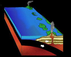
Late Cretaceous: 85 million years ago |
|
|
Mountain building begins to slow down. Erosion reduces the great Andean style mountain ranges. The giant magma bodies cool into large masses of igneous rock. These large structures are called batholiths and continued erosion eventually brings them to the surface. The volcanoes of previous times are eroded away and are replaced by new volcanoes. The Farallon Plate continues to slide slowly beneath the North American Plate. |
|
|
Continue to the Middle Eocene |
|
Text by Brad Riney
Diagrams by Lee Ellingson of Masters Presentation
Graphics (based on drawings by Brad Riney)
Field Guide |
Site Index |
Ocean Oasis Introduction
|
|
© 2000 San Diego Natural History Museum |