![[Ocean Oasis Field Guide]](images/bnr-oo-field.gif)
| |
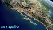
![[Where on Earth is Baja California?]](images/whereonearth.gif)
|
Baja California, along the southwestern edge of North America, lies between the latitudes of 32 degrees 30 minutes and 23 degrees—a range where deserts occur worldwide, both in the northern and southern hemispheres. The Baja California peninsula, about 760 miles (over 1220 kilometers) in length, is almost completely surrounded by water, with the Gulf of California (Sea of Cortés) to the east and the Pacific Ocean to the west. It is Earth's second-longest peninsula—only the Malay Peninsula is longer. For a video animation and an illustrated step-by-step summary of the geological process that formed the peninsula, beginning in the Late Jurassic period—140 million years ago—see "Plate Tectonics: How Baja California and the Sea of Cortés were Formed." Additional background information about the peninsula can be found in the Teacher's Guide. |
Field Guide |
Site Index |
Ocean Oasis Introduction
|
|
© 2000 San Diego Natural History Museum |